| s/y Nine of Cups Crossing the Great Australian Bight March 2014 |
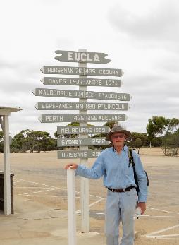
| The road was long and dusty, but offered some interesting sights. The remains of the old telegraph station is being gobbled up by the sand dunes. A monument to John Eyre, the first European to cross the Nullarbor Plain, is located close to the Eucla Roadhouse. Eucla turned out to be not much more than a couple motels, a caravan park and a small restaurant. There was also a tiny museum that we visited which offered more info about the telegraph station, as well as some brief history of Eucla. |
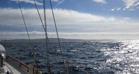
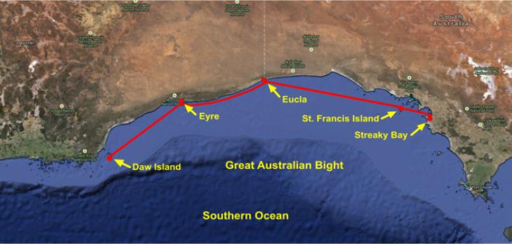
| Wiki defines the Great Australian Bight as “a large bight, or open bay, off the central and western portions of the southern coastline of Australia”. The coastline of the Bight is characterised by 400′ (120m) cliff faces known as the Bunda Cliffs, said to be the longest line of seacliffs in the world . The International Hydrographic Organization considers the Bight part of the southeastern Indian Ocean, but on all Australian charts and maps, it’s the Southern Ocean. It’s a 600 nm stretch of tough ocean passage marked by submarine “terraces” and “canyons” with depths ranging from ~16,000′ (5000m) to 164′ (50m) causing those southwest swells that prevail to become big rollers. The Great Australian Bight (GAB) was first noted by European explorers in 1627, when Francois Thijssen, a Dutch navigator sailed along its western margins. Our old buddy, Matthew Flinders, British navigator and cartographer was later the first to accurately chart the area in 1802, during his circumnavigation of the continent. The GAB runs east to west in alignment with the equator and is the longest ice-free coastline running in this direction in the Southern Hemisphere. Few cruisers transit the Bight for obvious reasons. There’s a certain amount of trepidation associated with that part of the world. The charting isn’t up-to-date and in many areas, “inadequately surveyed” shows up as a comment on even our electronic charts. We’ve known, however, several people who have crossed without incident and we've met fishermen who made their living in the area. Originally we thought we’d do as most others do … wait for a weather window and just get across. After chatting with Warrick on “Olein”who fished the area for many years and recommended seeing some of the Bight, we started to think about things a little differently. Though we’re keen to get across safely, we’ve never been known to hurry, so we looked into the possibilities. Warrick gave us his copy of Western Australia Cruising in exchange for some Tassie guides we had. Additionally, he provided several hand charts he used as a fisherman. We did a bit more research and decided we'd take a non-traditional, more scenic route. |
| St. Francis Island - 32S30.08 / 133E17.88 - 30' |
| Eucla Sands - 31S43.71 / 128E53.22 - 18' |
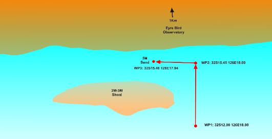
| Eyre Observatory - 32S15.46 / 126E17.94 - 18' |
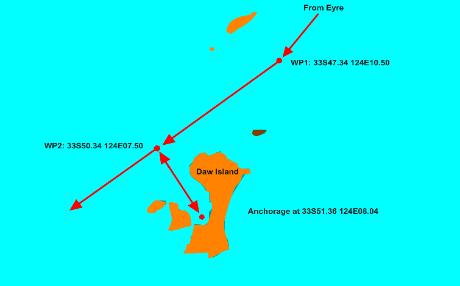
| Daw Island - 33S52.33 / 124E07.98 - 28' |
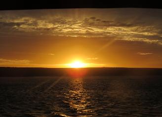
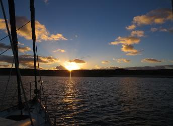
| The first leg of the passage should have been an easy one. We thought 54 nm from Streaky Bay to St. Francis Island would be a good introduction to the Bight without getting right into the thick of things immediately. It started out great with sunny, warm weather and light winds. Then it went all wrong. The clew was torn out of our jib, we were assaulted by "roll clouds", the likes of which we had never encountered before and once we arrived, our new anchor would not dig into the grassy bottom. All things seem catastrophic when they're happening, but with a bit of time, solutions appear. We removed the clewless yankee and hanked on our old genoa. The roll clouds, though vicious, were forgotten in no time. And the anchor, after giving it some time before backing down on it, finally grabbed and held tight. The sunset was gorgeous. We spent two days here waiting out strong westerlies and then headed for Eucla. |
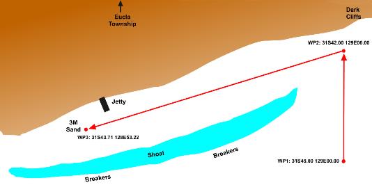
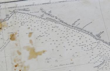
| The chartlet to the left with waypoints, shows our track getting into Eucla behind the shoals and shallows. The dark cliffs were very evident and contrasted sharply with the white cliffs near by. We could make out the dilapidated jetty as soon as we neared the anchorage. |
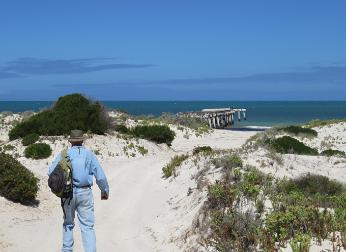
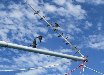
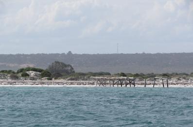
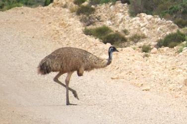
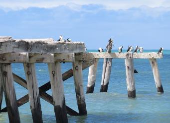
| Welcome swallows lit on the whisker pole before we even finished anchoring. Up close, the old jetty was even worse than it appeared at a distance and only served as a perch for hundreds of cormorants and gulls. We walked along a rutted, dirt road 5km to Eucla. We met an emu along the way. |
| We spotted Cups' mast bobbing up over the dunes and used it as our landmark to get back to the dinghy. |
| As we were heading back to the boat, a woman called and asked if we were from the sailboat anchored offshore. She offered us a ride back which we gratefully accepted. We asked about other possible anchorages and without hesitation, she turned around and took us back to her home where her partner, a veteran fisherman in the area, who hauled out a well-used chart and filled us in on other possible anchorages in the Bight and some tips on approaches. |
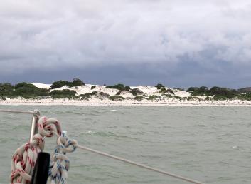
| The directions to the Eyre Bird Observatory anchorage were great and we anchored with no problems. From Cups' deck we could see lots of sand dunes, but the Observatory was hidden from view. |
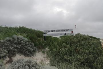
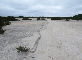
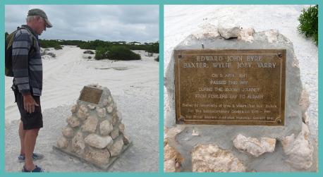
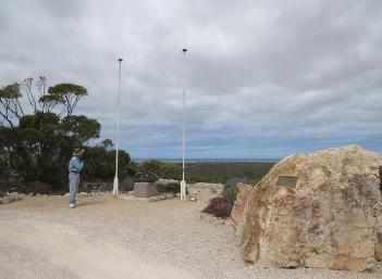
| Once ashore, we spotted the Observatory sign and followed a well-marked path. Along the way, we came across a memorial to Edward John Eyre and his three Aborigine guides. |
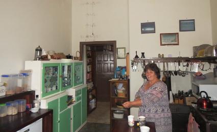
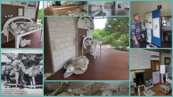
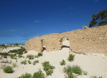
| The resident volunteers at the Bird Observatory were used to company. Kirsty had the tea kettle going within minutes of our arrival. After tea, we visited the little museum which told of a hard family life at the telegraph station. |
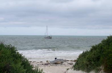
| Unfortunately all the birds we had hoped to see were elusive and we saw nary a one. The walk back to the boat was easy enough, but launching the dinghy into the surf proved another matter. We were pooped several times before we finally managed to clear the rollers and head back to Cups. We were totally drenched when we arrived, but exhilarated by the trip. |
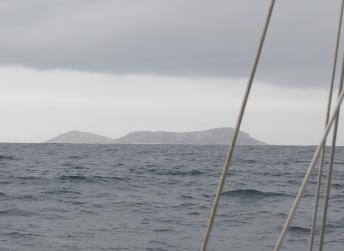
| Daw Island appeared grey and ominous on approach, but it turned out to be pure magic. |
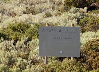
| We'd hoped to do some hiking on the island but the warning sign about "death adders in large numbers" deterred us. |
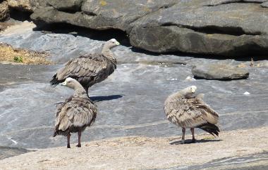
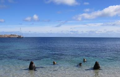
| Daw is uninhabited by humans, but seals and sea lions and Cape Barren geese all call it home. The next day dawned sunny and we walked the shore while curious sea lions watched our every move and followed us at a safe distance. Daw Island was the western end of the Great Australian Bight. We were across ... in one piece. Now ... on to Western Australia. |