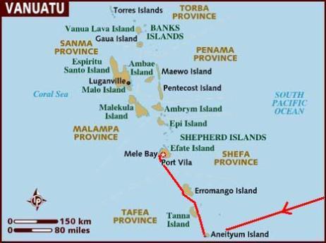
| s/y Nine of Cups Vanuatu Anatom, Tanna and Erromango Islands - August 2011 |
| Republic of Vanuatu (Ripablik blong Vanuatu) formerly: The New Hebrides Capital: Port Vila (Efate Island) Population: ~212,000 (est 2007) Language(s): English, French and more than 100 local Melanesian languages; Bislama or Bichelama, also known as Pidgin Area: 12,200 sq km (slightly larger than Connecticut) includes 83 islands, about 65 of which are inhabited Currency: Vatu (VUV) - $1US = 84.5 vatu High Point: Tabwemasana 1,877 m Time Zone: UTC+11 hours Multiple waves of colonizers, each speaking a distinct language, migrated to the New Hebrides in the millennia preceding European exploration in the 18th century. This settlement pattern accounts for the complex linguistic diversity found on the archipelago to this day. The British and French, who settled the New Hebrides in the 19th century, agreed in 1906 to an Anglo-French Condominium, which administered the islands until independence in 1980, when the new name of Vanuatu was adopted. |
| Vanuatu (van-WAH-too) means Our Land and the countries' inhabitants call themselves Ni-Vanuatu meaning "of Vanuatu". |
| Polynesia vs. Melanesia vs. Micronesia Vanuatu is in Melanesia and we've come from Polynesia and we're hoping at some point to go to Micronesia. We've heard these terms, but never understood the distinction between them. Polynesia from the Greek "poly" (many) and nesos (islands) includes most of the eastern South Pacific islands including French Polynesia, Samoa, the Cooks Islands, Tonga and many smaller islands. The people are golden-skinned and speak variations of the same mother tongue. Melanesia from the Greek "melas" (black) and nesos (islands) derives its name from its primarily black-skinned inhabitants. It includes New Guinea, the Solomons Islands, New Caledonia, Vanuatu and Fiji. Fiji has considerable Polynesian influence. Micronesia from the Greek "mikros" (small) and nesos (islands) and includes the thousands of little islands which make up the Marshalls, Mariana, Caroline and Gilbert groups. The term Polynesia was originally coined by Charles Brosse in 1756 and referred to all the Pacific Islands. In 1831, Durmont d'Urville restricted the term to its current usage and coined Melanesia and Micronesia to differentiate specific areas of the Pacific. |
| The first Christian missionary, a Canadian, the Reverend John Williams of the London Missionary Society, was sent to Erromongo Island in 1839. Upon arrival, he was promptly killed and eaten. Before cooking him, they laid him out and etched his outline on a flat stone. Oh, my! |
| Captain James Cook explored the area in 1774 and gave the island group the name New Hebrides because they reminded him of the Scottish islands. |
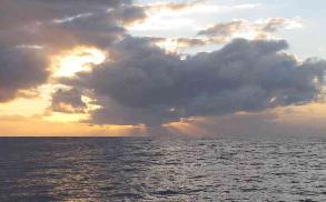
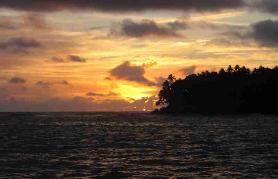
| The route from Suva to the island of Anatom (aka Aneityum) took us southwest about 550 nm. The going was slow and it took us 5 days to make the passage. We had some good days and some bad days. Above a sunset squall. |
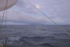
| Our first sight of Anatom was at dawn. The full moon was just setting in the west (above) silhouetting the island and the sun was rising in the east. Nature's perfect balance. |
| Anelgawat, Anatom (Aneityum) Island - 20S14.35 / 169E16.70 - 42' in sand |
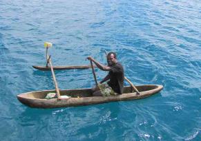
| We were still tidying up Cups when Jesse paddled up in his dugout canoe. He had been out fishing, but offered to show us around the village when we came to shore. |
| As we beached the dinghy, two little kids were sitting on the beach enjoying themselves. One with a handmade pinwheel and the other with a baby chick. |
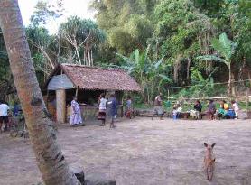
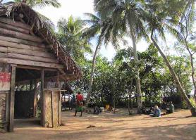
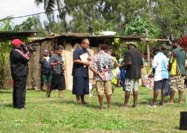
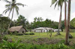
| The village of Anelgawat is one of three on the island. The community center meeting place, built cooperatively by the locals has a fresh market (shown) and a kava hut. |
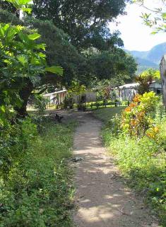
| There are no roads and no vehicles on Anatom. Streets are well-worn, hard-packed dirt paths which seem to lead everywhere throughout the town. |
| David shares raw peanuts with the kids on the beach. In addition to peanuts, the locals grow mandarins, papaya, grapefruit, banana, taro and breadfruit. |
| The Rev. John Geddie arrived at Anatom in 1848 and established the first Presbyterian mission in Vanuatu. |
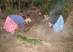
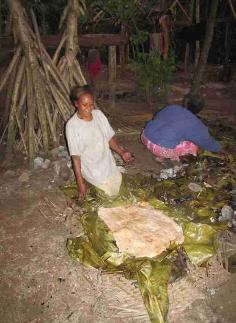
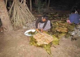
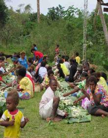
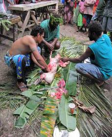
| During our visit, the village got together at the community center for a fund raising event which featured laplap, the national food. Laplap is comprised primarily of thinly sliced, layered taro, a starchy root crop. It is cooked in an earthern oven lined with volcanic rocks and thick layers of green palm leaves which are then covered with dirt. The finished product is removed after several hours and while hot, cut and served on fresh palm leaves as plates. It's quite tasty! |
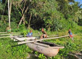
| Outrigger canoes are the primary mode of transportation here although there are some small boats with outboard motors. |
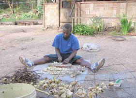
| We watched as villagers cut, sliced and ground up kava root for making the mouth-numbing national drink. |
| The kava hut was a popular place. Kava is a gray, dirty dishwater colored liquid served in coconut shell halves and has a bitter, peppery taste. Marcie's lips, tongue and throat were immediately numb. Any amount of dental work could have been performed at this point without complaint. |
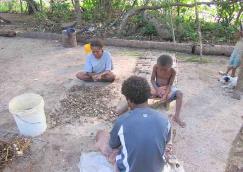
| Preparing kava is a community effort. |
| It is estimated that Vanuatu's population prior to European arrival in the early 19th century was about a million people. By 1870, it was reduced to 650,000 due primarily to disease brought by European explorers. By the end of the 19th c,the population fell to ~ 100,000 and continued its downward spiral to 1935 when only 40,000 Ni-Vanuatu remained. Today's population is ~200,000. Even today the greatest part of the population resides in small villages of 50 or less people. |
| More so than other island groups we've visited, we've had to be aware of possible health/safety issues in Vanuatu. It's a malaria, dengue fever area so we've had to keep slathered up with insect repellent. There's a cone shell whose occupant can give a near-death sting as well as rockfish and lion fish which sting. Salt water crocs some time arrive in the northern islands from the Solomons and sharks can be a problem in some of the bays. There are frequent volcano eruptions. Add that to the usual bad water and food-bourne amoeba, worms and parasites and you've got a lot to watch out for! |
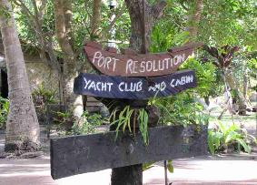
| Port Resolution, Tanna - 19S31.56 / 169E29.75 - 19' black mud |
| Anatom is the French name for the island and the one used on our charts. Aneityum is an adaption of the French name and Anajom is what the locals call their home island. |
| Dillon's Bay, Erromango - 18S49.268 / 169E00.696 - 33' in sand |
| The John Geddie Memorial Church stands in memory to the founder of the Presbyterian mission here on Anatom. |
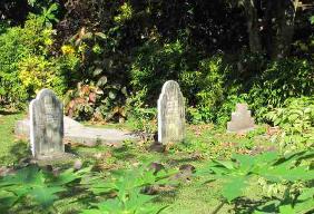
| Gravestones of the young children of the Rev. Wattlecoat from the late 1890's. |
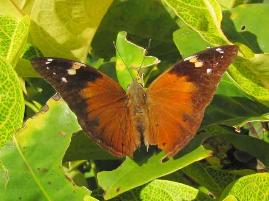
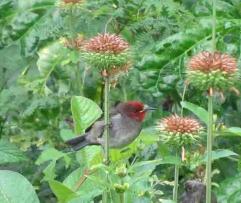
| Diadem butterflies are common here. |
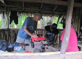
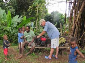
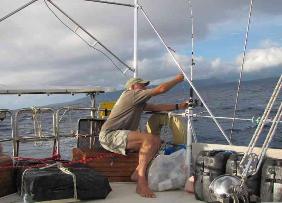
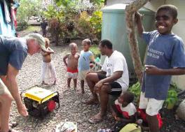
| David was a popular guy on the island when they found out he was an engineer and could "fix" stuff. He was 4 for 4 on generators, but didn't do as well with DVD players or inverters. |
| While anchored at Anatom, two earthquakes, 7.0+ magnitude, struck with an epicenter just 40 miles off Efate. No major damage reported and no tsunamis. We slept through it all. |
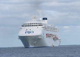
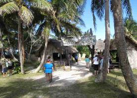
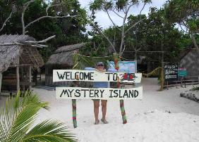
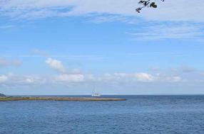
| Just across the bay from Anatom is tiny Mystery Island. Owned by the community, it is maintained and carefully cultivated for tourists.While we were there, the Pacific Jewel anchored nearby, the 62nd cruise ship of the season to stop here. |
| Mystery Island (Inyeug Island) |
| Nearly 2,000 passengers were disgorged upon the tiny island. Tenders ran back and forth constantly during the morning and afternoon and just as quickly as they arrived, they were gone. |
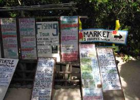
| The locals derive most of their income from the cruise boats that stop at Mystery Island. Above, tours and entertainment were offered from fishing, snorkeling and a crafts market to hair plaiting. |
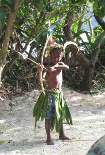
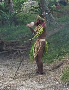
| A tiny ni-Van warrior posed for the cameras. |
| The locals will not stay on Mystery Island at night because they believe it to be haunted. |
| Once the cruise ship and its passengers left, we got permission to visit on our own. What a difference! |
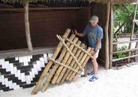
| David tries out a bamboo bass used by the community orchestra. A shoe sole is used to hit the ends of the bamboo tubes to generate the proper notes. |
| We found the island much more appealing without the crowds. White beach sand walking paths crisscrossed the island offering superb views of the reef. |
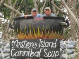
| Our favorite photo of the island...Nine of Cups crew soup! We may not include this recipe in the next Cups cookbook. |
| Reconciliation Ceremony |
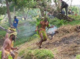
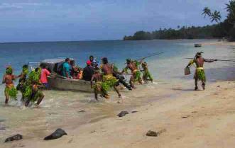
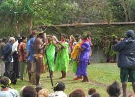
| In 1841, Samoan missionaries arrived at Anatom. They were butchered and eaten. For 170 years, the islanders have felt the shame of their ancestors' actions and have felt that any bad thing that happened to the island was due to the sins of their fathers before them. While here at Anatom, we were witness to a Reconcilation Ceremony where the islanders begged forgiveness and were forgiven. It was an extraordinary event. Above, a re- enactment of the first Samoans landing with warriors racing to the boat, brandishing spears and war clubs. If it was us, we would not have anchored! |
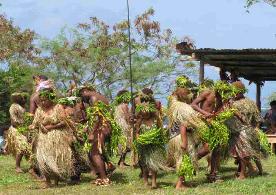
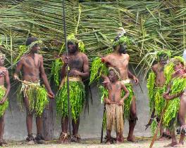
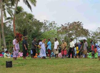
| The days were filled with ceremony and tradition. Above, a colorful group assembles for singing and dancing. |
| A welcome song and dance called the "salusalu" which is the traditional placing of a lei around the necks of the visitors. |
| A unique "kastom" dance followed with dancers in traditional dress. |
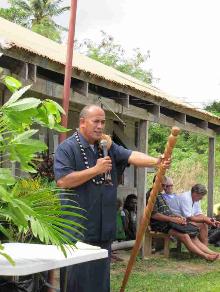
| The Reconciliation was about making apologies and receiving forgiveness. Village chief and ministers are blessed by the Samoan minister. |
The Samoan minister was
articulate, eloquent, charismatic
and most forgiving.
articulate, eloquent, charismatic
and most forgiving.
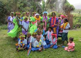
| Gifts were exchanged between the islanders and the Samoans. Forgiveness was the theme of these 4 days. After a most emotional and heartfelt ceremony, each member of the community queued up to shake hands with each member of the Samoan delegation. |
| A pig was slaughtered and prepared in a traditional manner for the evening feast. |
| Palm leaves spread on the ground were the tablecloths for the villagers who shared in the feast. |
| Around Anelcauhat Village |
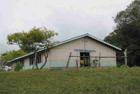
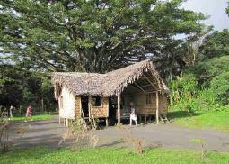
| Houses here are basic and either constructed of bamboo with thatch roofs or corrugated tin. |
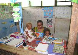
| There are two schools on the island and over 200 primary and high school students. |
| Our friend, Natu, teaches first grade. Above, in her classroom, she poses with her daughters, Leticia and Jessica. |
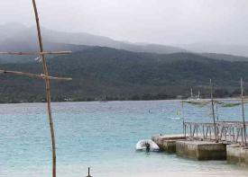
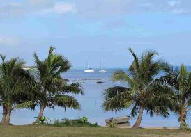
| The anchorage is calm and well protected. At one point, there were seven boats anchored here, waiting for weather to move on. |
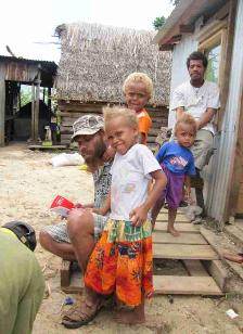
| Whenever David fixed equipment, it was an occasion for an audience. We got to know several villagers quite well. They "paid" us in vegetables, fruit and eggs. |
| Small, fast birds were common, but the villagers eat larger (slower) birds we think. They also eat dog and cat when meat is scarce. Wild pigs (tuskers) are common. |
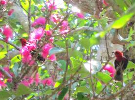
| Poinsettias, white and red, grow wild here, but are not native. Think of what we spend at Xmas time to get a flower like this! Yikes. |
| After 10 days at Anatom, we sailed along the island's west coast and headed north about 50nm to Port Resolution on Tanna Island. Tanna has several interesting things to see, but #1 is Mount Yasur, the most accessible active volcano in the world. We were keen to see it and we tolerated Port Resolution's notable rolly anchorage in order to make the trip up to the volcano's rim. |
| The locals know how to cater to yachts. |
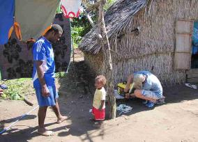
| We met Cyro, the village chief and his son, Randy, first thing. Wouldn't you know? The chief's generator wasn't working. |
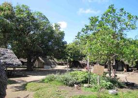
| Tidy Ireupuow (Ir-ah-poh) village aka Port Resolution, has a population of about 200 very friendly people. |
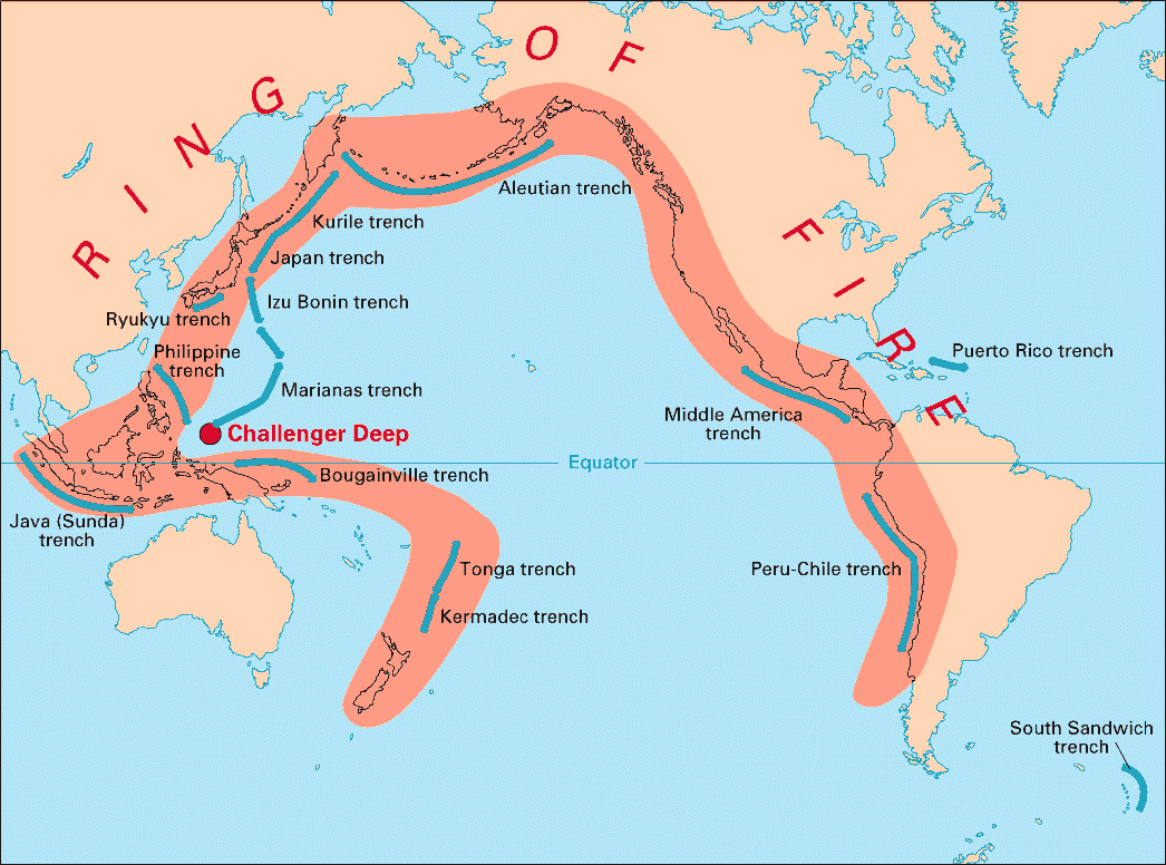
| The Pacific Ring of Fire is an area where the action of the Pacific tectonic plate being forced up and over the Indo-Australasian plate causes frequent earth tremors. Vanuatu lies in this area and is continually lifted up (2cm/year) in some areas and is sinking in others. There are nine active volcanoes in Vanuatu. |
| The village is very organized and Stanley, the yachtie coordinator, arranged a trip to the volcano via the village's 4-wheel drive, 1/2 ton Toyota truck, for us and another boat. |
| Tanna in the local language means "earth" and the island is known for its coffee plantations and gardens. |
| Port Resolution was named by Captain Cook after his own ship in 1774. |
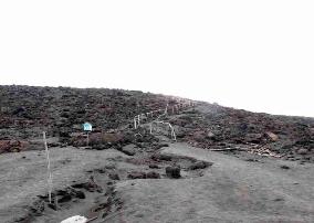
| The naturally black and white, barren land- scape on the steep path to the crater's rim. |
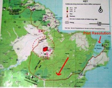
| A topo map of the area shows the large, red volcanic crater of Mount Yasur. The inlet known as Port Resolution was our anchorage. The brown line from Port Resolution shows our truck route up to the volcano. |
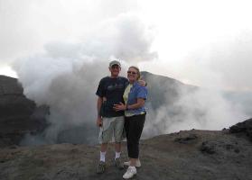
| Standing on the rim of an active volcano... how crazy can you get? |
| Erromango, named by Captain Cook, translates to "island of mangoes" in the local language or at least that's what he thought. In actuality, Cook asked what he was given and misunderstood ... it was a yam not a mango. |
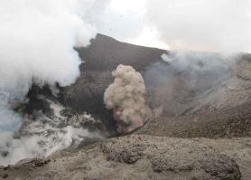
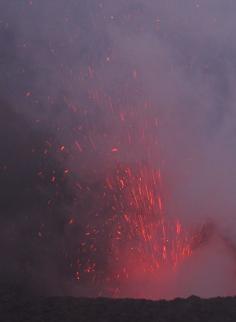
| The volcano belched thick brown smoke, heaps of steam and blue sulphurous vapor. |
| Once the sun set, all hell broke loose...literally...with a brilliant pyrotechnic display. |
| We departed Port Resolution at dawn |
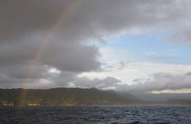
| Our view of the anchorage was stunning with steam vents rising in the cool morning. |
| A rainbow stretched from the sea and arced over the billowing volcano. |
| Two days at Tanna didn't seem enough, but there's so much to see in Vanuatu that a good weather window seemed foolish to ignore...plus with 7 other yachts in the anchorage, we needed to make room for new arrivals. The 54 nm trip from Port Resolution, Tanna to Dillon's Bay, Erromongo was downwind, fast and pleasant. After Tanna's rolly anchorage, Dillon's Bay was calm and serene. |
| We were the only yacht in the harbour at Dillon's Bay. We could have anchored in closer, but with all the earthquakes less than 40 miles from here, we worried about tsunamis and preferred the deeper water. We met Chief William and asked his permission to stay in the anchorage for a few days. "Stay a month", he said graciously, "you add flash to the harbour and we like flash." Our first day was spent wandering around the village, visiting the school and dinghying up the Williams River to collect fresh water for laundry. |
| Pastor Robbie gives David lessons on cleaning green coconuts. |
| We fished en route, but had no luck. The locals say that the area has been fished out by commercial fishing boats. |
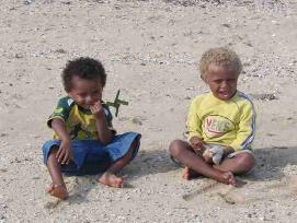
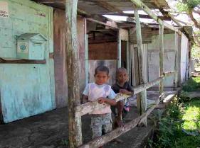
| Two little boys check us out when we first arrived. Many of the kids are somewhat afraid of "white faces". |
| Continue on to Port Vila, Vanuatu's "big smoke"on Efate Island, and the central islands. Come on...not afraid of cannibals, are you??? |
| "Cups" sits peacefully in Dillon's Bay, recently renamed Williams Bay after John Williams. There is a gravel bar that totally closes off the river at low tide, but is navigable by dinghy at mid-high tides. |
| David fixed a generator for Robbie (what a surprise) as well as a chainsaw. The longer David worked, the more "pickininnies" (Baslama for children) appeared in the yard. |
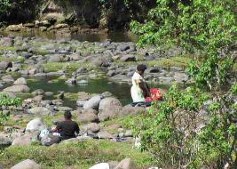
| We watched women washing their clothes the traditional way in the fresh water of the Williams River. |
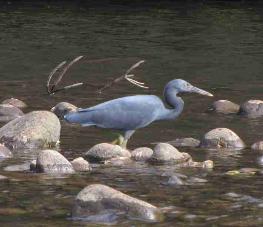
| In the river we saw the bluest blue heron we'd ever seen. |
| We went ashore one morning, but were met with long, teary-eyed faces and a tremendous wailing. A well-liked man in the village had been evac'd by plane from the island yesterday. The family had had to charter a flight in order for this to happen. Anyhow, word had just been received that he had died during the night. All the village women got together to "share" the grief with mournful wailing and keening...a haunting sound as it emanates from the huts. Robbie had planned to take us on a tour and Chief William had offered to take us to his beach and the burial cave of his ancestors, but with the death, they begged off understandably. The village would be in mourning for the next five days. We felt out of place here and returned to the boat. We would leave Erromango the next afternoon for the overnight passage to Vanuatu's capital city. |